The Blue Ridge Parkway
A Local’s Guide to the Drive of a Lifetime
If there’s one road I never get tired of driving, it’s the Blue Ridge Parkway. I grew up just a few miles from Rockfish Gap, where the Parkway begins, and it’s been my go-to escape for everything from quick sunset drives to full-blown weekend adventures.
I’ve lived near the Blue Ridge Parkway for most of my life, and let me tell you—this road never gets old. Every time I hop on, whether it’s for a quick Sunday drive or a multi-day ramble, I discover something new. Sometimes it’s a view I hadn’t noticed before, a quiet trail I’d overlooked, or a roadside apple stand with the best cider I’ve ever tasted.
If you're dreaming about winding mountain roads, wide-open overlooks, and peaceful trails that seem to lead into the clouds, this is your kind of place.
What Is the Blue Ridge Parkway?
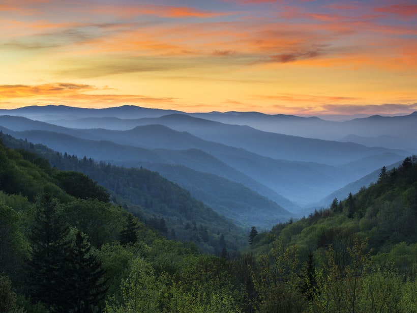
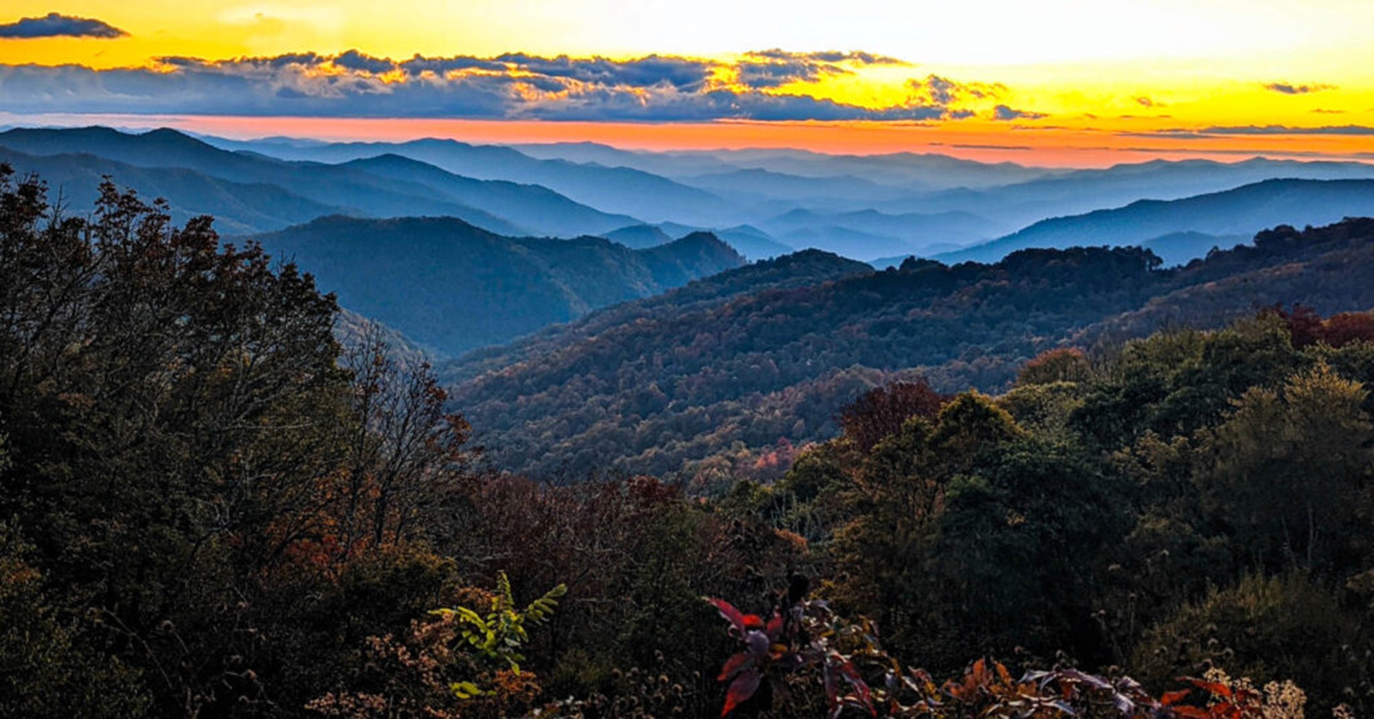
The Parkway stretches 469 miles, connecting Shenandoah National Park in Virginia to Great Smoky Mountains National Park in North Carolina, offering stunning views and unforgettable landscapes along the way. Designed to blend into the land, it meanders through forested ridges, rolling farmland, and Appalachian peaks without the usual distractions—no billboards, no stoplights, and very few intersections as it weaves its way through some of the most jaw-dropping scenery on the East Coast.
But it’s more than just a scenic road. It’s essentially a long, narrow national park with hiking trails, historic sites, waterfalls, and wildlife tucked along the route.The Parkway isn’t just about getting from Point A to Point B. It’s about slowing down, pulling over often, and soaking in the beauty. This isn’t interstate driving—it’s more like meandering through a living postcard.
Where Does It Start and End?
The northern gateway is Rockfish Gap, near the little mountain village of Afton, Virginia, where it picks up right where Skyline Drive through Shenandoah ends. From there, it heads south all the way to Cherokee, North Carolina.
Here’s a little local tip: If you’re starting at Rockfish Gap, give yourself a day or two to explore Nelson County and the Nelson 151 Wine and Brewery Trail before you even hit the Parkway. The area is jam-packed with vineyards, craft breweries, hiking trails, and local eats—so it’s worth giving yourself a night or two to explore before heading south.
How Long Does It Take to Drive?
The drive itself could technically be done in about 12–15 hours. But that’s missing the point. I always suggest at least three days, and preferably more if you want to hike, take side trips, and really soak it all in.
One of my favorite Parkway trips lasted five days. We camped one night, stayed in two little inns, and spent a lot of time just sitting at overlooks drinking coffee out of thermoses. You can’t rush the Parkway—it’s all about the journey.
Top Attractions Along the Blue Ridge Parkway - My Favorite Things to Do
I’ve been up and down the Parkway more times than I can remember—on solo hikes, fall drives with friends, and early morning coffee runs that turned into entire-day adventures. If you’re new to the area or just want to make sure you’re hitting the highlights, here are some of the best places to stop, stretch your legs, and soak in the Blue Ridge beauty. I’ve listed them from North to South…
Humpback Rocks (Milepost 5.8)
Right near Afton, this is a perfect starter hike. It’s steep but short, and the view from the top makes your heart skip a beat. I’ve taken dozens of visiting friends here, and they all end up speechless at the summit. Check out our in-depth local’s guide to Humpback Rocks to get the full scoop before you hit the trail.

White Rock Falls (MP 18.5)
Tucked into the woods between Humpback Rocks and the Whetstone Ridge area, this is one of my favorite quiet hikes. It’s less crowded than nearby trails, and the waterfall at the end is the perfect spot to cool your feet on a summer afternoon. The trail’s moderate, shady, and peaceful—just the way I like it. Check out our White Rock Falls page for trail tips, hidden photo spots, and everything you need to know before you lace up your boots.

Apple Orchard Mountain (MP 76.5)
At 4,225 feet, this is the highest point on the Parkway in Virginia. Look for the giant radar dome on top—it’s like a big white golf ball in the sky.

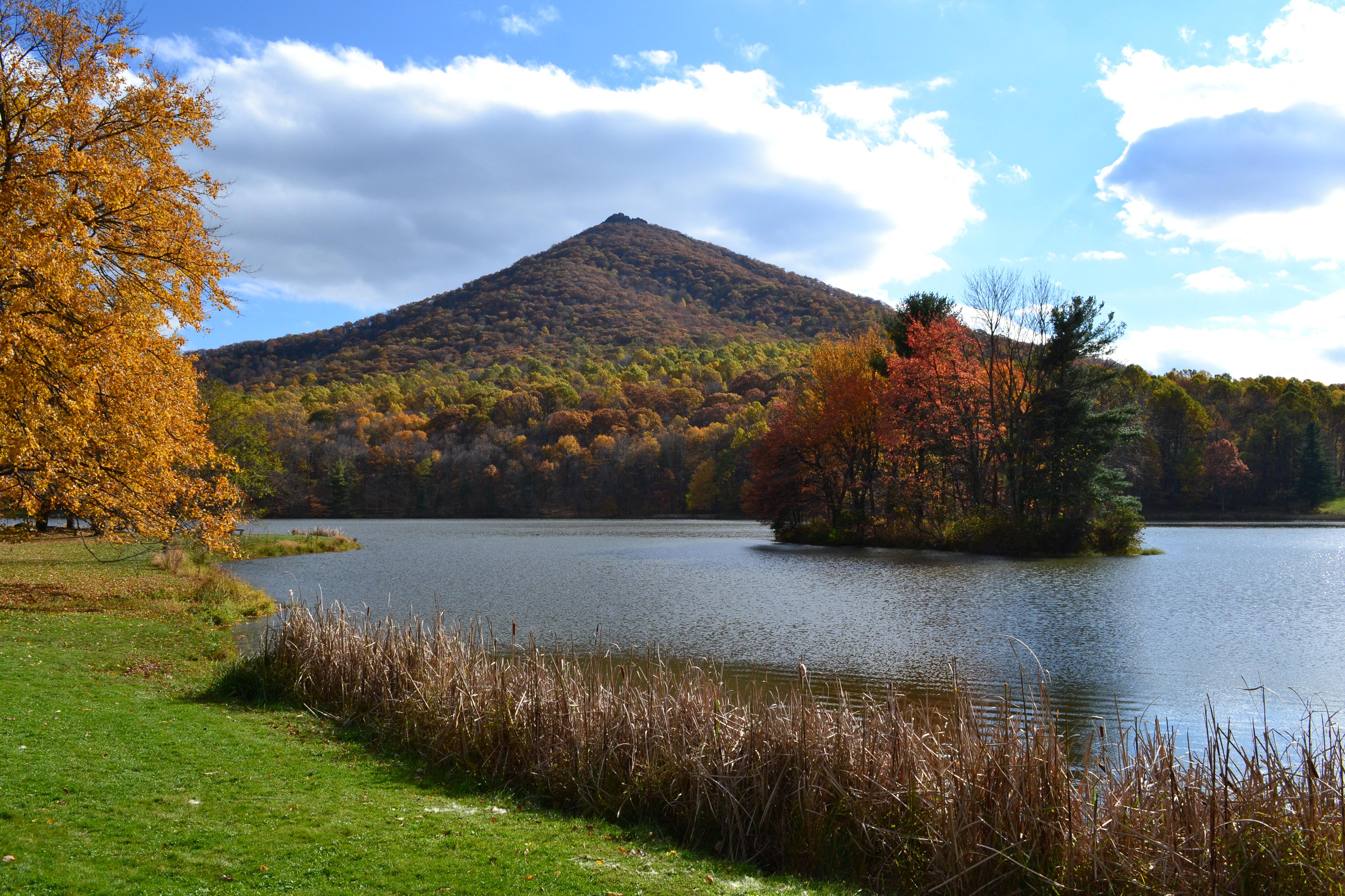
Peaks of Otter (Milepost 86)
This is one of the most scenic areas in Virginia. Take the shuttle or hike to the top of Sharp Top Mountain. The views are stunning, especially in fall. The lake here is a peaceful spot for a picnic or paddle.
Rocky Knob & Rock Castle Gorge (MP 169)
A lesser-known gem with a killer backcountry trail. If you're into solitude, this is your spot. Pack water—it's a real workout.

Mabry Mill (Milepost 176.1)
If there’s a “postcard” of the Parkway, this is it. It’s probably the most photographed spot on the Parkway. The waterwheel is iconic—and the pancakes at the on-site restaurant are just as legendary. Go early before the tour buses arrive and walk the short trail around the mill.

Blue Ridge Music Center (MP 213)
Love mountain music? This is your place. Free exhibits during the day, live concerts in the summer, and the friendliest folks around.

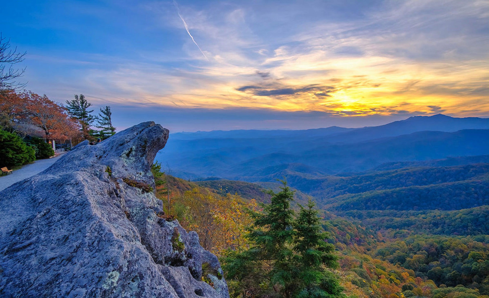
The Blowing Rock (Near MP 291)
A short detour from the Parkway gets you to this quirky attraction with a wild legend and an even wilder view. Good for photos and browsing the little gift shop.
Moses H. Cone Memorial Park (MP 294)
Gorgeous estate with miles of carriage trails for hiking or horseback riding. The manor house also has craft demonstrations and local goods.

Julian Price Memorial Park (MP 297)
Lake, picnic tables, paddle boats—this is one of my favorite places to bring visiting family. It’s super kid-friendly and never feels too crowded.

Linville Falls (Milepost 316.4)
This is one of the most beautiful waterfalls on the Parkway. There are a few different trails, so you can choose your own adventure depending on how much time and energy you’ve got.

Linn Cove Viaduct (Milepost 304.4)
This S-curve bridge wraps around Grandfather Mountain and seems to float over the trees. There’s a great little trail below it for those classic “Instagram from the rocks” photos.

Little Switzerland (MP 334)
Charming mountain village with an inn, a bookstore, and some truly tasty pie. It feels like stepping into a postcard.

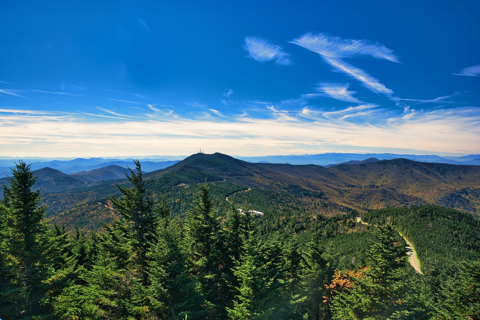
Mount Mitchell (MP 355.4)
The tallest peak east of the Mississippi! You can drive most of the way up and take a short walk to the summit. Bring a jacket—it's chilly even in summer.
Craggy Gardens (Milepost 364.4)
In June, the rhododendrons here explode in color. The Craggy Pinnacle Trail is short, a bit rocky, and ends with panoramic views that feel like you’re standing at the edge of the world.
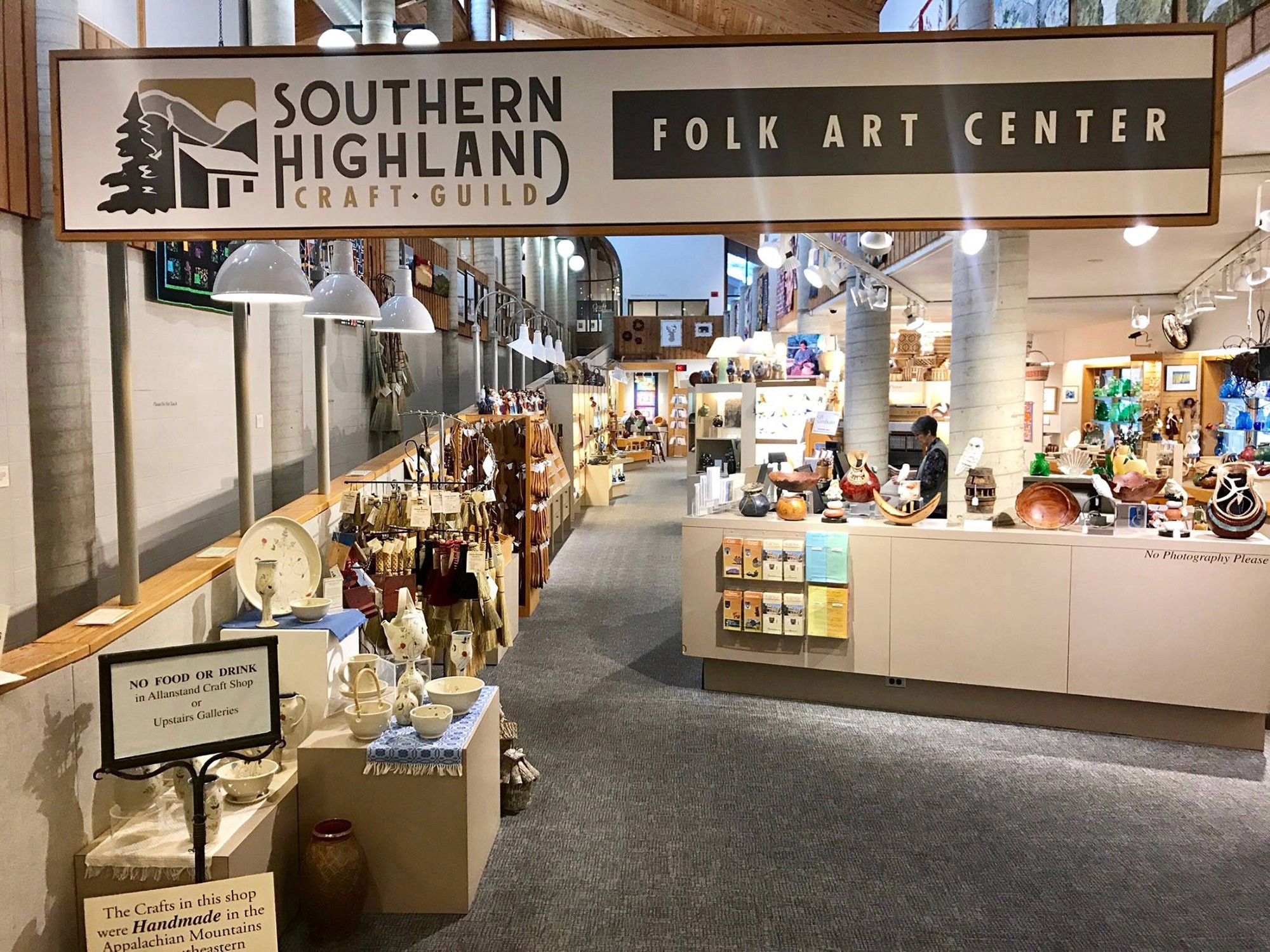
Folk Art Center (MP 382)
Located just outside Asheville, this is where you’ll find top-notch Appalachian crafts, from handmade quilts to blown glass. And yes, it's air-conditioned.
Graveyard Fields (MP 418.8)
Don’t let the spooky name fool you—it’s a beautiful valley hike with waterfalls, wildflowers, and berry picking in late summer.

Waterrock Knob (Milepost 451.2)
My go-to sunset spot. It’s a steep, short hike to the summit, and you can see four states on a clear day. Pack a picnic, bring a blanket, and stay until the stars come out.
Cherokee, NC (MP 469)
The Parkway ends (or begins, depending on your direction) in Cherokee, where you can explore Native American history, visit the Museum of the Cherokee People, or try your luck at the casino.
Where to Stay Along the Parkway
There’s no shortage of places to sleep along the Parkway, whether you want to rough it with a tent or relax in a cozy lodge. Here’s where I recommend staying:
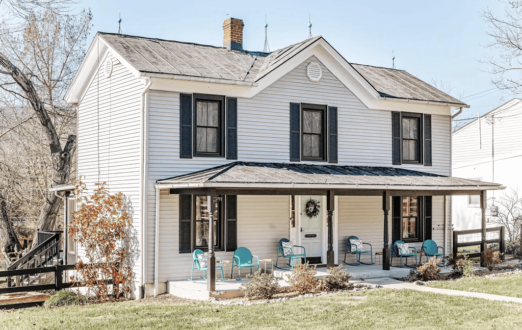
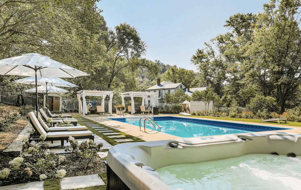
Afton Mountain Inn (Milepost 0 - Afton, VA)
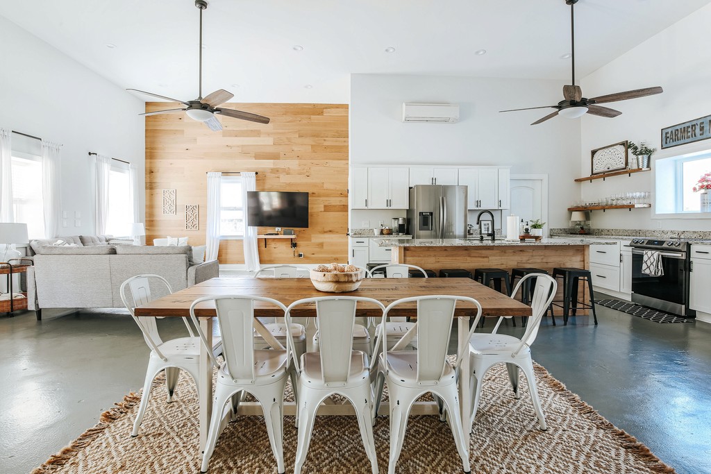
If you’re starting at the northern end, this is the place to kick off your journey. Set on 10 beautiful acres just minutes from the Parkway’s start, Afton Mountain Inn has a resort-style pool, two hot tubs, three fire pits, a creekside nature trail, and outdoor swings where you can sip wine and listen to the birds. Built in 1848, it’s got a cozy, boutique vibe with luxurious suites, a two-bedroom villa, and all the local charm you could want. Plus, it’s close to the Route 151 Wine & Brew Trail and Shenandoah National Park. I’ve stayed here and sent countless friends—and everyone raves about it.
Peaks of Otter Lodge (Milepost 86)
Right on the lake and surrounded by trails, this old-school lodge has charm and convenience. The restaurant is solid, and it’s a great base for a night or two. The lake view rooms are perfect for early morning coffee on the balcony, and the restaurant serves hearty comfort food after a long hike.
Pisgah Inn (Milepost 408.6)
Sitting at 5,000 feet, this place feels like you’re floating above the clouds. The views from your room are unreal. It books fast, especially in fall, so plan early.
Parkway Campgrounds
There are several great Parkway campgrounds: Julian Price, Linville Falls, and Mount Pisgah are three of my favorites. They’re peaceful, tree-covered, and close to great hikes. Bring your own firewood and get ready for s’mores and stargazing.
Nearby Towns
If you want to duck off the Parkway for a night, towns like Boone, Blowing Rock, Asheville, and Floyd are full of friendly locals, amazing food, live music, and cool little shops. Asheville is especially vibrant, with breweries galore and an artsy mountain vibe.
Blue Ridge Parkway Maps & Navigation: What You Need to Know
Let’s talk logistics. Cell service can be spotty or nonexistent along the Parkway, so don’t count on your phone for everything.
Here’s what I always recommend:
Download offline maps using Google Maps or Gaia GPS before you start.
Get a paper Parkway map from the National Park Service or one of the visitor centers along the route. I keep mine in the glovebox like a treasure map—it’s come in handy more times than I can count.
The Blue Ridge Parkway Travel Planner (by the Blue Ridge Parkway Association) is another great option. It has milepost markers, trail descriptions, and suggested itineraries.
Mileposts run from north (MP 0 at Afton) to south (MP 469 at Cherokee), and they’re clearly marked on the roadside. If you see a great overlook and want to come back to it later, jot down the milepost!
Pro tip: Use the Parkway’s mileposts to plan your stops like breadcrumbs along a trail. I often plan a day around hitting every cool spot between, say, Milepost 250 and 300.
And just to make things even easier for you, below you’ll find a custom Blue Ridge Parkway map complete with highlights, must-see stops, and local tips from yours truly.
Local Tips for a Great Drive
Drive in the early morning or late afternoon for the best light. Midday can be hazy, especially in summer.
Bring layers. The weather can change quickly—especially at higher elevations.
Stop often. The best moments come when you least expect them.
Don’t rely on GPS alone. Cell service is unreliable, so download maps or bring a paper copy.
Pack snacks and water. Some stretches are pretty remote, and services are few and far between.
Fall is king. Aim for mid to late October, depending on elevation. The colors are unreal, but it does get crowded.
Wildlife is active at dawn and dusk. I’ve seen bears, wild turkeys, and even a bobcat once near Julian Price Lake (no photo proof—just a blurry memory and a quick heartbeat).
20 Interesting Facts About the Blue Ridge Parkway
I’ve been exploring the Blue Ridge Parkway for years, and every time I find something new that surprises me. Whether you're seeing it for the first time or coming back for the tenth, there's always another hidden overlook, quirky bit of history, or scenic detour waiting for you. Below are 20 of my favorite facts about the Parkway—some fun, some useful, and all worth knowing before you hit the road. Let’s jump in!
It’s the Most Visited National Park Unit in the U.S.
The Blue Ridge Parkway often ranks as the most-visited site in the National Park System, beating out even Yellowstone and the Grand Canyon.It’s 469 Miles Long
The Parkway winds from Afton, Virginia (Milepost 0) to Cherokee, North Carolina (Milepost 469)—no stoplights, no billboards, just scenic beauty.It Took Over 50 Years to Finish
Construction began in 1935, but the final stretch wasn’t completed until 1987. That last piece? The Linn Cove Viaduct—an engineering marvel that hugs the side of Grandfather Mountain.No Commercial Trucks Allowed
The Parkway is designed for leisurely travel, so commercial traffic is banned—one reason it feels so peaceful.There Are No Gas Stations on the Parkway
Make sure to fill up before you hop on! I’ve had a few close calls myself. Towns like Waynesboro, Floyd, and Blowing Rock are good pit stops.You’ll Cross 26 Tunnels (All in North Carolina)
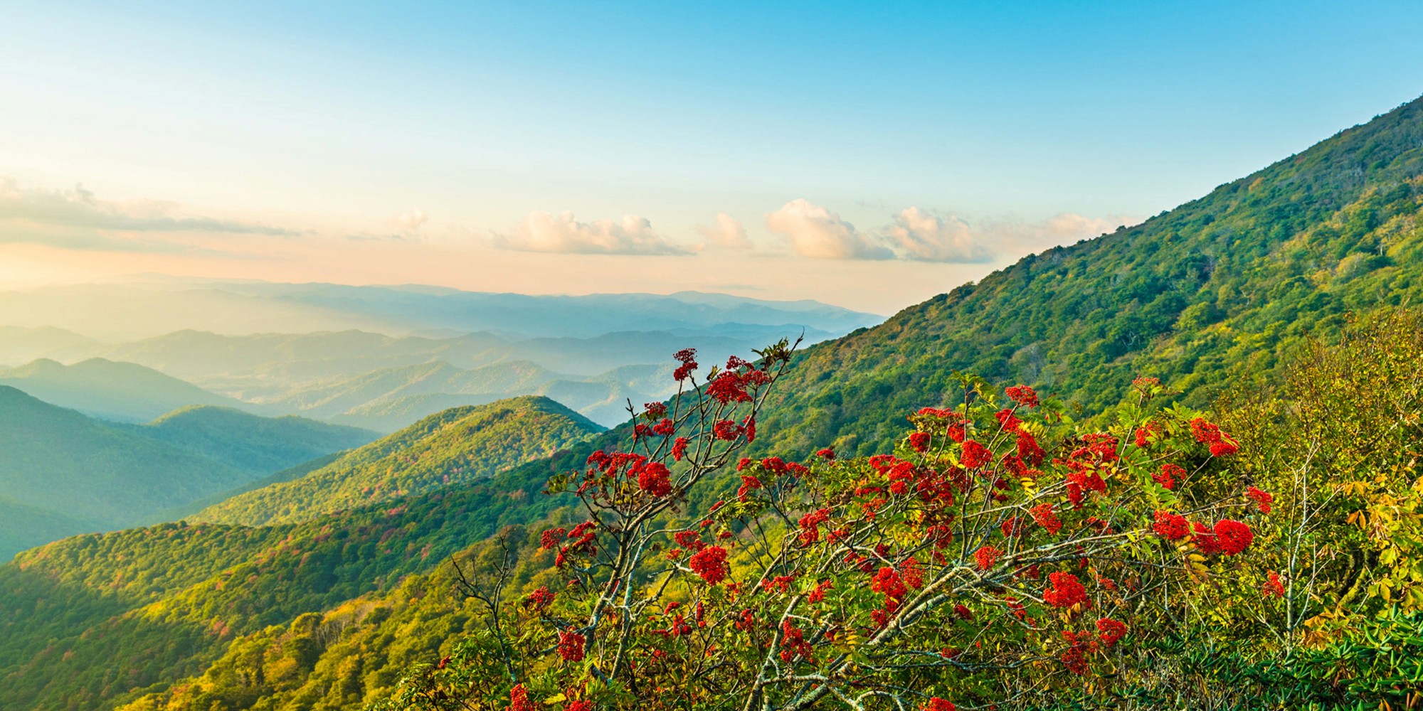
They carved right through the mountains to preserve the ridgelines—so don’t forget to turn your headlights on!It’s a Botanist’s Paradise
The Parkway is home to over 1,600 species of plants, including flame azaleas, rhododendrons, and mountain laurels.There Are No Billboards or Stoplights
You won’t see a single billboard or traffic light along the entire Parkway. It was designed to feel like a journey through nature, not through a string of towns.Mileposts Are Your Best Friend
Each overlook, trailhead, and visitor center is marked by a milepost. They run from MP 0 (Afton, VA) to MP 469 (Cherokee, NC). I always jot down milepost numbers when I find a favorite spot.Elevation Varies Dramatically
The road ranges from 649 feet near the James River to over 6,000 feet near Mount Pisgah in North Carolina.It’s Free to Drive
No toll booths, no entry fees, no passes needed. It’s one of the only national park sites that’s completely free to visit.Fall Foliage Is World-Famous
Peak colors happen between late September and early November depending on elevation—locals will tell you, it’s the best leaf-peeping in the country.You’ll Pass Dozens of Overlooks
There are over 200 scenic overlooks along the route, each one worth a photo (or ten).Plenty of Hikes Start Right Off the Road
Trails like Humpback Rocks, Crabtree Falls, and Rough Ridge begin right from the roadside parking. There are over 350 miles of hiking trails just off the Parkway. Some are quick strolls to waterfalls, others are all-day treks with big summit payoffs.There Are Waterfalls Galore
You’ll find cascades like Linville Falls (MP 316), Crabtree Falls (MP 339), and Fallingwater Cascades (MP 83.1). Some are a short walk; others make for a full-on hike. All are worth the stop.It’s Open Year-Round—But Not Always Passable
Winter weather and maintenance can lead to temporary closures, especially at high elevations. Always check road conditions before you go.You Can Sleep in Historic Lodges
Places like Peaks of Otter Lodge (MP 86) and Pisgah Inn (MP 408) offer cozy stays right on the Parkway. For a boutique stay at the northern entrance, I always recommend Afton Mountain Inn—it’s just minutes from Humpback Rocks and has a pool, hot tubs, and a creekside trail.The Parkway Has Its Own Set of Rules
While part of the National Park Service, the Parkway is a unique scenic byway with special regulations—camp only in designated spots and stay on trails.Camping Is Available Along the Way
There are eight campgrounds run by the NPS along the Parkway—some first-come, some reservable.It’s a Photographer’s Dream
Between foggy valleys at sunrise and golden hour views at sunset, there’s no shortage of jaw-dropping photo ops.
Final Thoughts
The Blue Ridge Parkway is my favorite road in the world. It’s not just about where you’re going—it’s about how you get there. It’s where I’ve made some of my best memories, and I still find something new every time I drive it.
Whether you’re road-tripping with the kids, hiking solo, or just looking for a peaceful place to watch the sunset, the Parkway is a place that sticks with you. So pack a cooler, cue up your road trip playlist, and hit the road slow. The mountains are waiting.
Blue Ridge Parkway FAQ
What is the Blue Ridge Parkway?
The Blue Ridge Parkway is a scenic highway that runs through the Appalachian Highlands, connecting Virginia’s Shenandoah National Park with North Carolina’s Great Smoky Mountains National Park. It's known as “America’s Favorite Drive” for good reason—rolling mountains, overlooks for days, and plenty of chances to stretch your legs at waterfalls, trails, and historic spots.
Where does the Blue Ridge Parkway start and end?
The Parkway starts near Afton, Virginia (just off I-64 at the south end of Skyline Drive), and runs all the way to Cherokee, North Carolina, right near the entrance to Great Smoky Mountains National Park. It spans 469 miles of pure mountain beauty.
Is it part of the National Park Service?
Yes! The Blue Ridge Parkway is actually a unit of the National Park System. It’s managed much like a national park, but it’s officially a scenic byway with lots of park-like stops along the way.
Does the Blue Ridge Parkway have a highway number?
Not exactly. It doesn’t have a traditional route number like most highways. You'll see it labeled as the Blue Ridge Parkway on maps, but it's technically "NPS Route 374" in the Park Service system. Most folks just call it "the Parkway."
Is it free to drive the Parkway?
Yep—no tolls, no entry fees. Just gas up your car, pack a picnic, and hit the road.
What’s the difference between Skyline Drive and the Parkway?
Skyline Drive is the 105-mile road that runs through Shenandoah National Park. It connects directly to the Blue Ridge Parkway at its southern end near Afton, VA. Think of Skyline Drive as the northern sibling to the Parkway—they look similar, but each has its own feel.
How long does it take to drive the whole Blue Ridge Parkway?
If you’re just cruising straight through, you could do it in 12 to 15 hours. But that would be missing the point. Most folks take 3 to 7 days to enjoy it fully, stopping at hikes, overlooks, and local towns along the way.
How should I plan a Blue Ridge Parkway road trip?
Start with how many days you’ve got, then pick a section or two to explore. If you have a week, you could do the whole thing. If you only have a weekend, try the stretch near Asheville or around Roanoke. Grab a map, look up some hikes and overlooks, and go with the flow—there’s no wrong way to do it.
When is the Parkway open?
The Parkway is open year-round, but sections may close temporarily in winter due to snow or ice. There’s no plowing in most places. Fall is especially popular for leaf-peeping, and spring brings beautiful wildflowers. Always check the Parkway road closures map before heading out, especially in colder months.
Is the Parkway open at night?
Yes, it’s open 24/7 unless weather or roadwork closes a section. That said, it’s not lit, and the curves can get tricky after dark—so take it slow if you’re driving at night.
Where are the main access points?
Some of the easiest spots to hop on the Parkway include Afton (VA), Roanoke (VA), Fancy Gap (VA/NC border), Blowing Rock (NC), Asheville (NC), and Cherokee (NC). Just look for signs pointing to the Blue Ridge Parkway or BRP.
How fast can I drive on the Parkway?
The speed limit is usually 45 mph, sometimes less in tighter curves or near popular stops. It’s meant to be a slow, scenic ride—no rush, just enjoy the view!
How do I get onto the Parkway from Asheville?
There are a few entrances right near Asheville, but the most popular one is at milepost 382, near the Folk Art Center on U.S. 70. From downtown, it’s about a 15-minute drive.
Can I use Google Maps to follow the Parkway?
Kind of. Google Maps will usually try to route you the fastest way, which means jumping off the Parkway. To stay on it, search for “Blue Ridge Parkway” and set your stops using mileposts or known attractions. Or go old-school with a paper map—trust me, it’s worth it.
How many miles is the Parkway?
The Blue Ridge Parkway runs for 469 miles from end to end.
Where’s the halfway point of the Parkway?
Around milepost 235 near Doughton Park in North Carolina. It's a great place to stop and stretch.
Where does it cross I-81?
Near Roanoke, Virginia. There are multiple exits off I-81 that connect to the Parkway, including one near Buchanan and another closer to Christiansburg.
When do the rhododendrons and mountain laurel bloom?
Mid to late spring, typically May and June, depending on elevation. In higher spots, it may be closer to late June. The Parkway lights up with pinks, whites, and purples—absolutely magical.
Are there any tunnels on the Parkway?
Yes! Especially in North Carolina, where you'll pass through more than 25 tunnels carved into the mountainside. They’re part of the Parkway’s charm.
What’s the most scenic part of the Parkway?
That’s tough—it depends on what you like! Near Asheville, you’ll find big views and lush greenery. The Peaks of Otter area in Virginia is great for hiking. And near Linville and Grandfather Mountain, the Parkway feels like you’re driving through the sky. The Linn Cove Viaduct is especially jaw-dropping.
Where can I stay along the Parkway?
There are a few lodges and campgrounds right on the Parkway—like Afton Mountain Inn, Peaks of Otter Lodge or Pisgah Inn. Or, you can stay in nearby towns like Afton, Boone, Asheville, or Waynesville and just hop back on the Parkway during the day.
Are RVs allowed on the Parkway?
Yes, but be careful—there are lots of sharp curves, steep grades, and tunnels with height restrictions (as low as 10’6” in some places). Check tunnel heights before you go.
Can I camp along the Parkway?
Absolutely. There are designated campgrounds like Otter Creek, Rocky Knob, Doughton Park, and Julian Price. Backcountry camping is allowed in certain spots with a permit.
Can you hike the whole Parkway?
You can’t walk directly along the road for all 469 miles, but there are over 360 miles of hiking trails throughout the Parkway corridor, including sections of the Appalachian Trail.
What’s the deal with the “Blue Ridge Turnpike”?
That’s an old term from the 1800s—it was a rough wagon road in Virginia that inspired part of the Parkway’s route. Not used much today, but it pops up in historical references.
Is it pet-friendly?
Yes! Pets are welcome on trails and in campgrounds, as long as they’re on a leash. Just keep them away from overlooks—those drops are no joke.
When was the Parkway built?
Construction began in 1935 and wasn’t completed until 1987. It was a massive, decades-long project meant to boost tourism and provide jobs during the Great Depression.
How’s the fall foliage on the Parkway?
Incredible. Peak leaf color hits anywhere from late September to late October, depending on the elevation and weather. Virginia tends to peak earlier than North Carolina. It’s one of the best leaf-peeping drives in the country.
What’s the Parkway like in winter?
Beautiful and quiet, but also more prone to closures. Ice and snow aren’t cleared in most sections, so always check road conditions first. Some overlooks are amazing when frosted over.
Can I see the Biltmore from the Parkway?
Not really—the Biltmore is nearby, especially around milepost 388 near Asheville, but it’s tucked away in the hills. You’ll need to visit separately (and it’s worth it!).
Can I drive it in one day?
Technically, yes. But it would be a very long day with minimal stopping. You’re better off taking your time and soaking it in.
Is it scary to drive?
If you’re used to mountain driving, it’s not bad. The curves can be tight and there are no guardrails in many places, so go slow and don’t drive distracted. Avoid it at night or in fog if you’re nervous.
Can I fly a drone on the Parkway?
Not without a special permit. Drones are generally not allowed on National Park Service land, and that includes the Parkway.
Where can I get info about the Parkway while on the road?
Stop by visitor centers like the Humpback Rocks (VA), Peaks of Otter (VA), or the Blue Ridge Parkway Visitor Center in Asheville (NC). They’ve got maps, rangers, and local advice.
What’s the speed limit again?
Usually 45 mph, but it can drop to 25 or 35 in certain areas. Take it slow—it’s part of the experience.
Can I sleep in my car?
Not overnight in pull-offs or parking lots. You’ll need to stay in designated campgrounds or lodging.
Is it safe to travel solo?
Definitely. Just make sure you have gas, snacks, and maybe a backup paper map. Cell service can be spotty in the mountains.
Can I carry a firearm on the Parkway?
Federal law allows firearms in national parks if you follow state and local laws—but they’re not allowed in buildings or visitor centers. Always check the latest regulations.
Is it worth it?
Absolutely. Whether you're a hiker, biker, road tripper, or just in it for the views, the Blue Ridge Parkway is one of the most scenic and peaceful drives in the country. You’ll remember it forever.